Air Visual Drone Services, LLC
See More. Decide Faster. Reduce Risk with Professional Aerial Data.

About Air Visual Drone Services
Air Visual Drone Services is a veteran-owned drone mapping and inspection company specializing in high-accuracy aerial data that helps businesses and public agencies make informed decisions while reducing operational risk. We combine advanced UAV platforms with survey-grade sensors including thermal imaging and photogrammetry technology, paired with professional workflows to deliver precise orthomosaics, digital elevation models, 3D point clouds, and comprehensive asset-condition reporting. Our certified pilots and experienced mapping technicians follow industry best practices for safety, data quality, and regulatory compliance.
We serve commercial, industrial, and municipal clients across diverse sectors including infrastructure inspection, construction progress monitoring, solar and utility asset inspection, and emergency response support. Whether you need a single-site thermal roof inspection, repeatable construction mapping for earthwork pay applications, or high-precision topographic surveys for engineering, we tailor each project to your required tolerances, turnaround times, and deliverable formats. We prioritize straightforward pricing, timely communication, secure data delivery, and most importantly, safety—our pilots are trained, insured, and operate under all applicable regulations and approvals.
Our Services
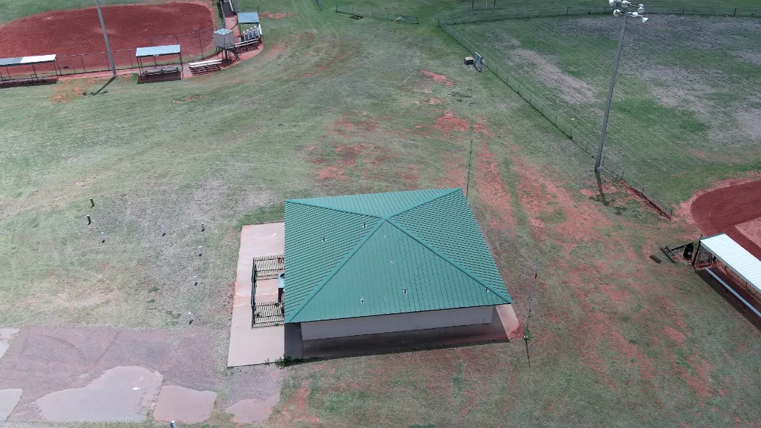
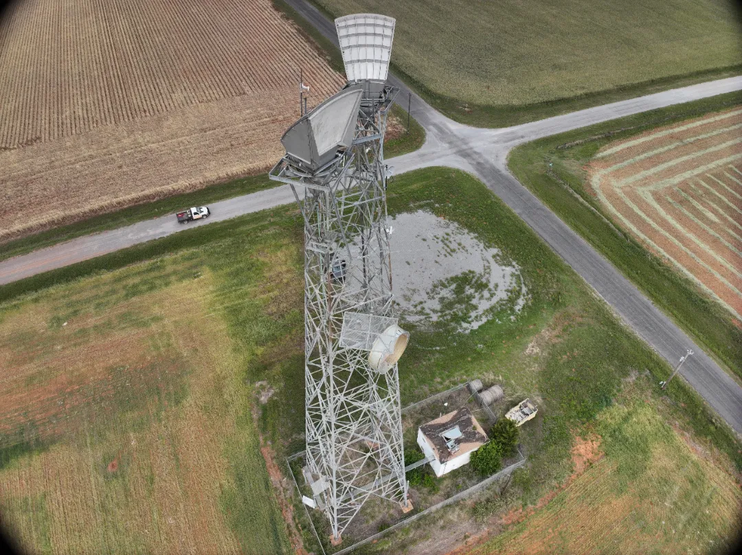
Aerial Mapping & Surveying
High-precision orthomosaics, digital elevation models, and 3D point clouds for construction monitoring, topographic surveys, and engineering applications. Includes RTK/PPK positioning and ground-control placement for survey-grade accuracy.
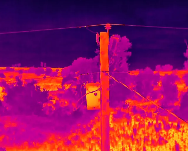
Thermal & Asset Inspection
Thermal imaging inspections for roofs, solar arrays, utility assets, and infrastructure. Detailed asset-condition reporting with automated change detection and advanced analytics to identify maintenance needs and reduce operational risk.
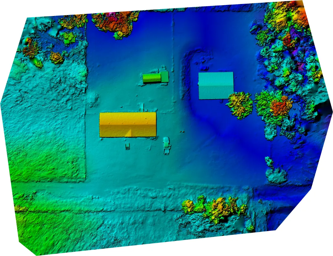
Specialized Surveying Solutions
Volumetric calculations, emergency response support, and custom analytics. Deliverables in GeoTIFF, LAS, XYZ, PDF reports, and CAD/GIS-ready formats tailored to your project requirements.